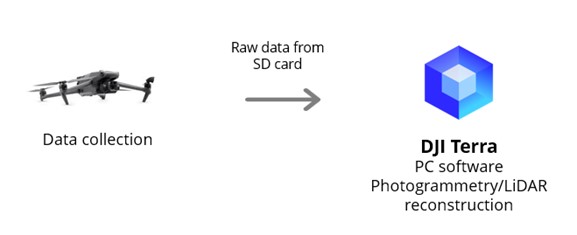
DJI Terra: A software introduction
In the rapidly evolving world of drone technology, DJI continues to push the boundaries with innovative solutions. One such groundbreaking tool is DJI Terra, a powerful software platform designed to turn raw drone data into actionable insights. Let's take a deep dive into the key features and capabilities of DJI Terra and explore how it's changing the game for professionals across industries.
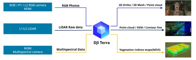
The Core of DJI Terra: Three Key Data Sources
DJI Terra's strength lies in its ability to process and analyze data from three primary sources, each offering unique capabilities for different applications:
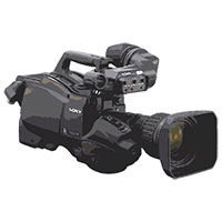
1. RGB Camera Systems
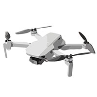
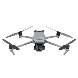
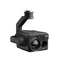
Hardware: M3E / P1 / L2 RGB camera, M3D (with Dock 2)
Input: RGB Photos
Output: 2D Ortho / 3D Mesh / Point cloud
The RGB camera systems capture high-resolution color imagery, which DJI Terra transforms into:
Detailed 2D orthomosaic maps
Accurate 3D mesh models
Dense point clouds for precise measurements and analysis
These outputs are invaluable for applications such as construction site monitoring, urban planning, and cultural heritage preservation.
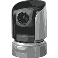
2. LiDAR Technology
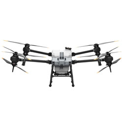
Hardware: L1/L2 LiDAR
Input: LiDAR Raw data
Output: Point cloud / DEM / Contour line
LiDAR (Light Detection and Ranging) technology provides highly accurate distance measurements, which DJI Terra processes into:
Detailed point clouds for 3D visualization
Digital Elevation Models (DEM) for terrain analysis
Contour lines for topographic mapping
LiDAR technology is essential for forestry management, flood modelling, and infrastructure inspection.
3. Multispectral Imaging
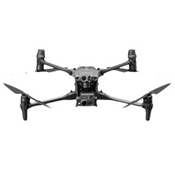
Hardware: M3M Multispectral camera
Input: Multispectral Data
Output: Vegetation indices maps (NDVI)
Multispectral cameras capture data across multiple spectral bands, which DJI Terra analyzes to produce:
Vegetation indices maps, including Normalized Difference Vegetation Index (NDVI)
To get the precision agriculture, multispectral usage is important, allowing farmers to assess crop health, optimize irrigation, and improve yield management.
Additional Features and Capabilities
DJI Terra goes beyond basic data processing, offering a suite of additional features that enhance its versatility:
Coordinate System Support:
Conversion between various coordinate systems
Support for localized coordinate systems
Data Import and Parameters:
7 parameters and PRI import
GCP (Ground Control Points) integration
Basic Measurement & Annotation:
Simple measurement tools
Annotation capabilities
Sharing features (to be released in overseas markets)
Detailed Inspection Mission Planning:
Specialized tools for power facility inspection scenarios
Basic Flight Mission Planning:
While not a core function, it provides fundamental mission planning capabilities
Industry Applications
The versatility of DJI Terra makes it an invaluable tool across numerous industries:
Construction: Monitor progress, calculate volumes, and plan site logistics
Agriculture: Optimize crop management and increase yields
Surveying and Mapping: Create accurate topographic maps and 3D models
Infrastructure Inspection: Assess the condition of bridges, towers, and pipelines
Environmental Monitoring: Track changes in ecosystems and assess environmental impact
Disaster Response: Rapidly map affected areas and plan relief efforts
DJI Terra represents a significant leap forward in drone data processing and analysis. By seamlessly integrating data from RGB cameras, LiDAR sensors, and multispectral imagers, it provides professionals with a powerful toolkit for turning aerial data into actionable insights.
Whether you're a surveyor, farmer, engineer, or researcher, DJI Terra offers the tools you need to unlock the full potential of your drone data. Experience the future of aerial data analysis with DJI Terra.
For more information send an email to: [email protected]


 UAE
UAE KSA
KSA